Devastation and Fear in the Wake of a Major Quake
On the morning of October 10, 2025, a powerful 7.4-magnitude earthquake struck off the southern coast of the Philippines, causing widespread panic, structural damage, and tragic loss of life. The tremor, centered at sea approximately 62 kilometers southeast of Manay town in Davao Oriental province, prompted immediate tsunami warnings and mass evacuations along the coastline.
Government Mobilizes Emergency Response
President Ferdinand Marcos Jr. confirmed that damage assessment is ongoing while rescue and relief operations are being organized. He assured the public that emergency teams would be deployed once safety conditions are confirmed.
The Philippine Institute of Volcanology and Seismology (PHIVOLCS) reported that the quake originated from the Philippine Trench at a depth of 23 kilometers. The agency warned of possible aftershocks and structural hazards in affected areas.
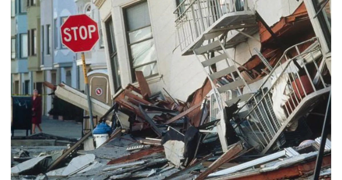
Casualties and Infrastructure Impact
At least one person was killed by falling debris in the south, according to Bernardo Rafaelito Alejandro IV, Deputy Administrator of the Office of Civil Defence. While details remain limited, reports indicate several buildings suffered damage.
In Davao City, cracks were observed in multiple structures, including the international airport, which continued operations despite the damage. No flight cancellations were reported.
Eyewitness Accounts Reveal Intensity
Disaster mitigation officer Jun Saavedra from Gov. Generoso town described the chaos:
“I was driving when my car started swaying. Power lines were swinging violently. People rushed out of homes and buildings as electricity went out.”
He noted that this was the strongest earthquake the region had experienced, with schools and public buildings developing visible cracks.
Students Injured Amid School Evacuations
At least 50 students from a high school in Gov. Generoso were transported to the hospital after suffering from dizziness, fainting, or minor injuries during the quake. As a precaution, all educational institutions in the town suspended classes.
In Davao City, home to more than 5.4 million residents and the largest urban center near the epicenter, children were swiftly evacuated from schools. Many families gathered in open areas, holding their loved ones tightly as aftershocks continued to rattle the region.
Tsunami Threat and Coastal Evacuations
The Pacific Tsunami Warning Center in Honolulu confirmed that small tsunami waves were recorded along parts of the Philippine and Indonesian coasts. The threat passed roughly two hours after the initial tremor, though small fluctuations in sea level may continue.
Alejandro cautioned residents in six coastal provinces to remain alert and evacuate to higher ground, noting that tsunami waves could have followed the quake within a two-hour window.
In Indonesia, small waves between 3.5 to 17 centimeters were reported in several areas of North Sulawesi province, including Melonguane, Beo, Essang, and Ganalo in the Talaud Islands.
Still Reeling from Previous Disaster
This seismic event comes just days after the Philippines suffered a 6.9-magnitude quake on September 30, which killed at least 74 people and displaced thousands in Cebu province, particularly in Bogo City and nearby towns.
Why the Philippines is Prone to Disasters
The Philippines lies along the Pacific Ring of Fire, a highly active seismic zone where tectonic plates frequently collide, causing earthquakes and volcanic eruptions. The country also faces around 20 typhoons annually, placing immense pressure on government and volunteer-based disaster response systems.
Other Regional Activity: Papua New Guinea Quake
In a related event, a 6.0-magnitude earthquake was also reported off the coast of Papua New Guinea on the same day. The quake struck in the Bismarck Sea, about 414 kilometers northeast of Lae, the country’s second-largest city. Fortunately, local authorities reported no significant damage.